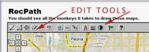
Many of you may know about Rec Path but for those who don’t I highly recommend this site for planning your runs. When arriving in a new location (or from home) I’ll locate my hotel on Google Earth and with “satellite” view look for green space, trails, rivers or any place that might offer a great run. Then I’ll pull up Rec Path and map my run with this easy to use tool. It calculates your distance as you plot the run and if you make a mistake you can easily remove the last points you may have placed in error. You can also view and plot your Rec Path runs in “satellite” view if you desire. Want to start over just click the erase tool and begin again. From my experience the distances I plot using Rec Path are pretty close to the totals on my Forerunner 205.
Ken
